 |
| The Oosterschelde Flood Barrier gates. |
The Dutch have a saying: "God made the Earth, but the Dutch made Holland." For more than 800 years the Dutch have been building barriers to hold back the North Sea. Dunes, dikes, dams, barrier gates, sluices and pumps shield the low flat territory of their country from the invasion of sea water. When it comes to flood control, nobody beats the Dutch.
 |
| The Dutch lowlands: flat, as far as the eye can see. |
About two-thirds of the Netherlands is susceptible to flooding. Its land area averages eight feet below sea level (one area of land called the Zuidplaspolder is 23 feet below sea level!). This "Low Country" is getting lower by the day. Much of the Netherlands' reclaimed land is comprised of drained peat bogs, and peat bogs contract when drained. The reclaimed land sinks about a quarter inch each year. Preventing all that North Sea water from flooding their lowlands is a major preoccupation for the Dutch. Flood control is the country's number one priority.

There have been some major floods in the Netherlands' history, of course. The last big one was in 1953 when a North Sea storm surge killed more than 1800 people. In response the Dutch government has added new flood control works, including the Oosterschelderkering (Oosterschelde storm surge barrier) on the southeast coast. This enormous delta works has 62 floodgates, 19 to 29 feet high. The gates are left open most of the time but are shut when the high water alarm goes off (about twice a year), to prevent flooding from the North Sea.
 |
| On the Neeltje Jans |
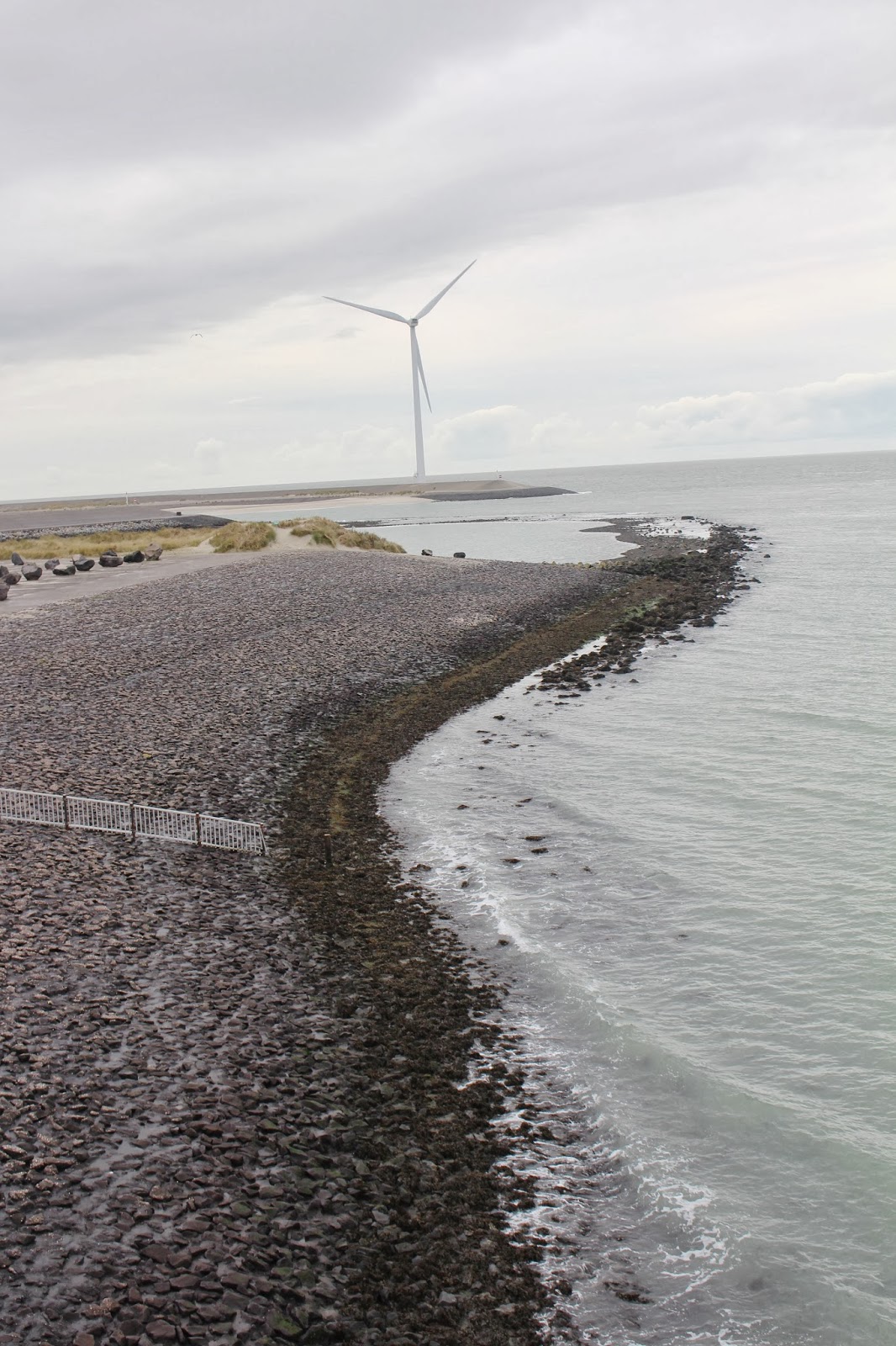
On our way to Amsterdam we drove out to see this engineering marvel, declared to be one of the modern Seven Wonders of the World by the American Society of Civil Engineers. Once we entered the province of Zeeland, the landscape was the classic Dutch lowland, dotted with picturesque villages and ancient windmills. It was a long drive along the Midden-Zeeland Peninsula to the Neeltje Jans, an artificial island that was created during the construction of the Oosterschelderkering. This is a great place to view the delta works. The scenery out there is spectacular!

There are many modern windmills in the neighborhood of the Neeltje Jans. I was able to stand at the foot of one, something I've always wanted to do back home. The windmills we have in our part of Pennsylvania are perched on mountain ridges, and are not so accessible; it's difficult to understand how huge they are from a distance. Standing next to one is a humbling experience. The windmill I got gezellig with is about 300 feet tall. The enormous blades made a powerful swooping sound as they turned. It made me feel very, very small…
Walking from the windmill to the barrier gates road we came upon a curious group of large boulders, arranged on intersecting white lines in what looked like a parking lot. There was no sign nearby to explain what it was.
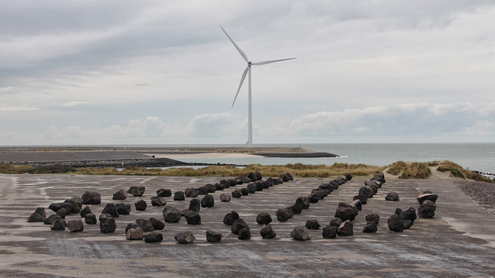
When I got to Amsterdam I did some sleuthing online and found out that this is a work of "landscape art" by Dutch artist Marinus Boezem. It's the layout of the Reims Cathedral created with lines and stones. Boezem created an earlier, more famous version of this using growing Lombardy poplars in Almere: http://www.depaviljoens.nl/page/286?lang=en
Interesting.
 |
| Reims Cathedral layout, birds-eye view of the Neeltje Jans "Cathedral." |
Near the road that runs along the flood barrier gates, overlooking the Neeltje Jans "cathedral," we passed a stone monument with an inscription that poetically proclaims the engineering genius of the Dutch people :
Hier gain over het tij, de wind, de naan en wij
Here the tide is ruled, by the wind, the moon and us.

No comments:
Post a Comment